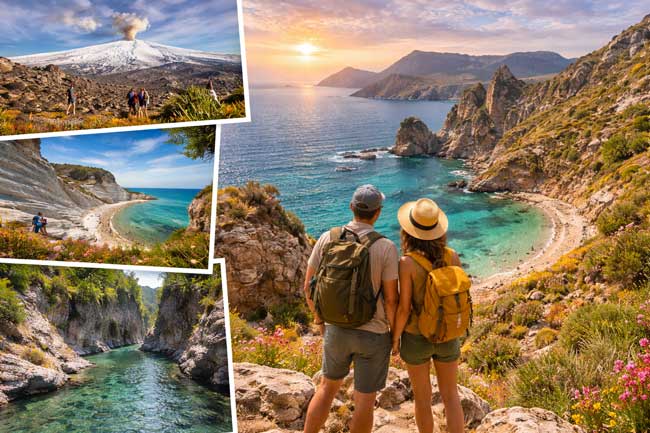
Sicily is not only a destination for baroque architecture, street food and ancient temples. It is also one of the most varied hiking environments in the Mediterranean a single island that contains Europe’s most active volcano, three mountain ranges, the longest coastal nature trail in western Sicily, a canyon with 5,000 Bronze Age rock-carved tombs and two active volcanic islands accessible by hydrofoil from the coast. The terrain ranges from sea level to 3,357 metres within a day’s drive, and the trails range from gentle coastal paths with swimming stops to serious mountaineering objectives that require preparation and a licensed guide.
This guide covers the best hiking in Sicily by zone, with honest difficulty ratings, practical access information and the specific details that distinguish each experience from the alternatives. Whether you are a casual walker who wants a morning on a coastal trail with a swim at the end, or a serious hiker looking for a multi-day mountain traverse, Sicily has the route.
In this guide
- Mount Etna summit hike and crater circuits
- Zingaro Nature Reserve the coastal trail
- Stromboli the night hike
- Pantalica Canyon the Bronze Age gorge
- Madonie Mountains Pizzo Carbonara and Piano Battaglia
- Nebrodi Mountains the long ridge
- La Rocca di Cefalù the easiest summit in Sicily
- Magna Via Francigena the island crossing
- Vulcano Gran Cratere the Aeolian short hike
- When to hike in Sicily
- Practical tips
- FAQ
Sicily hiking quick reference by difficulty
- Easy (suitable for most walkers): Zingaro coastal trail, La Rocca di Cefalù, Vulcano Gran Cratere, Pantalica lower canyon
- Moderate: Etna lower slopes and Circumetnea trails, Madonie forests, Nebrodi sections, Valle del Bove viewpoint
- Demanding: Etna summit hike (guide required above 2,900m), Pizzo Carbonara, Stromboli night hike
- Multi-day: Magna Via Francigena (183 km), Dorsale dei Nebrodi (70 km)
- Best season: April to June and September to October
- Guide required: Etna above 2,900m, Stromboli above 400m
Mount Etna Summit Hike and Crater Circuits
Mount Etna is the most iconic hiking destination in Sicily and one of the most specific hiking experiences in Europe. At 3,357 metres, it is Europe’s highest active volcano, and the landscape in the upper third of the mountain black lava desert punctuated by steaming sulphur vents, the rock turned yellow and orange at the crater rims, the sea visible 60 kilometres below on three sides is unlike any other walking environment in Italy.
The standard approach from the southern slope begins at Rifugio Sapienza (1,900m), reachable by car from Catania in approximately 90 minutes. The cable car (funivia) ascends to 2,500m; from there, a jeep shuttle reaches 2,900m the departure point for the on-foot summit ascent to the crater area at 3,000 to 3,200m. A licensed volcanic guide is compulsory above 2,900m. The ascent from the jeep drop-off takes approximately 45 minutes to 1 hour; the total round trip from Rifugio Sapienza, including the cable car and jeep, is approximately 4 to 5 hours. Physical requirement: moderate to good fitness and proper closed shoes with grip. The altitude gain from the cable car top station is 700 metres on loose volcanic terrain; trekking poles are useful for the descent on scoria.
The lower slopes of Etna offer additional hiking options that are accessible without the cable car and without a guide: the Valle del Bove viewpoint trail (the massive volcanic depression on the eastern slope, one of the most dramatic landscapes on the mountain), the Grotta di Serracozzo circuit (volcanic caves, pine forests and lava field crossings, approximately 5.8 km, 2.5 to 3 hours), and the various wine-country paths through the Etna DOC vineyards on the northern slope. These lower-slope routes are accessible year-round in appropriate weather and do not require a guide. Read our complete Mount Etna guide and Etna wine guide for the full picture.
👉 MOUNT ETNA SUMMIT HIKE WITH LICENSED VOLCANIC GUIDE
A guided half-day hike to the Etna summit craters with a licensed volcanic guide cable car and jeep transfer included, summit access above 2,900m and the geological explanation that makes the experience complete. Available from Catania and Taormina.
👉SEE THE BEST MOUNT ETNA SUMMIT HIKING TOUR HERE
Zingaro Nature Reserve the Coastal Trail
The Zingaro Nature Reserve on the northwestern coast of Sicily offers the finest coastal hiking in the island 7 kilometres of completely unspoilt Tyrrhenian coastline between Scopello in the south and San Vito Lo Capo in the north, accessible only on foot. The main coastal trail runs along the cliff edge above the sea through Mediterranean scrubland of euphorbia, wild rosemary and lentisk, with five descents to coves below: Cala dell’Uzzo, Cala Capreria, Cala Marinella, Cala Mazzo di Sciacca and Cala Berretta, each accessible by a short descending path from the main trail.
The full one-way trail takes approximately 3 to 4 hours at a comfortable pace with swimming stops. The trail can be walked in either direction from the southern Scopello entrance northward, or from the San Vito Lo Capo entrance southward. The southern entrance (Scopello) is the most dramatic approach: the 16th-century tonnara and the limestone faraglioni in the bay of Scopello below provide the finest visual approach available on the trail. The northern entrance gives a gentler, less dramatic arrival but is convenient for those coming from San Vito Lo Capo.
Difficulty: Easy to moderate. No significant elevation gain; the terrain is rocky path rather than paved. Appropriate footwear: trail shoes or solid walking sandals. Bring everything you need for the day water (1.5 litres minimum in summer), sunscreen, a hat and a swimsuit. There are no permanent food or water facilities inside the reserve. Entry costs approximately €5. Arrive at the southern entrance before 9am in July and August. Read our complete Zingaro Nature Reserve guide.
Stromboli the Night Hike
The night ascent to the summit crater rim of Stromboli the most continuously active volcano in the world, erupting at regular intervals for at least 2,000 years is the most dramatic hiking experience available in the Sicilian islands and one of the most specific outdoor experiences in the Mediterranean. The climb of 900 metres of altitude gain on volcanic terrain takes approximately 2.5 to 3 hours; a licensed guide is compulsory for all access above 400 metres.
The timing of the ascent is designed to reach the crater rim at nightfall, when the lava glow from the eruptions (which project incandescent material 100 to 300 metres into the air at intervals of minutes) is visible against the dark sky rather than washed out by daylight. The descent is by headtorch on the same path. Total round trip: 5 to 6 hours. The eruptions are viewed from the crater rim on the far side of the active vent, at a safe but dramatically close distance. On clear nights, the reflection of the eruptions on the sea below and the lights of the Aeolian Islands on the horizon provide one of the most specific visual experiences available in the Mediterranean outdoors.
Difficulty: Demanding. 900 metres of altitude gain on loose volcanic scoria, in darkness on the descent. Good physical fitness required. Appropriate footwear: closed hiking shoes or trail runners. Book guide and Stromboli accommodation weeks in advance for July and August. Read our complete Aeolian Islands guide for access information from Milazzo.
👉 STROMBOLI NIGHT HIKE TO THE CRATER RIM
A guided night ascent to the summit of Stromboli with a licensed volcanic guide the 900m climb, the crater rim at nightfall and the live eruptions of the world’s most continuously active volcano visible in the darkness. One of the most extraordinary outdoor experiences in the Mediterranean.
👉SEE THE BEST STROMBOLI NIGHT HIKING TOUR HERE
Pantalica Canyon the Bronze Age Gorge
The Pantalica Necropolis, approximately 40 kilometres northwest of Syracuse, is one of the most haunting walking environments in Sicily and the most specific combination of natural landscape and archaeological heritage available on the island on foot. The canyon is carved by the Anapo and Calcinara rivers through limestone plateau, with the rock faces of the gorge honeycomb-drilled with more than 5,000 chamber tombs of the Sicel civilisation carved between approximately 1200 and 700 BC, making this the largest Bronze Age necropolis in Sicily and a UNESCO World Heritage Site.
The main trail through the lower canyon follows the river through the gorge, with the tomb openings visible in the cliff faces at multiple levels above the path. The combination of the river sound, the shade of the canyon, the ancient tombs in the rock and the vegetation of the gorge oleander, poplar, willow and wild fig creates a walking experience of considerable atmosphere. The full canyon circuit is approximately 12 kilometres and takes 4 to 5 hours; shorter versions of 5 to 7 kilometres are accessible for less experienced walkers. Difficulty: easy to moderate depending on the route selected. No guide required; trail maps are available at the entrance. Read our complete guide to Noto for the broader Val di Noto context.
Madonie Mountains Pizzo Carbonara and Piano Battaglia
The Madonie Mountains, 70 kilometres east of Palermo, contain the highest peaks in Sicily outside Mount Etna Pizzo Carbonara at 1,979 metres is the highest and the most biodiverse mountain ecosystem on the island. The Madonie Regional Park protects forests of ancient beech, oak and the Abies nebrodensis, a fir tree species that was once widespread across the Mediterranean and now exists in the wild in fewer than 30 individual trees in a single valley of the Madonie. The trail to see these trees in the Madonna degli Angeli valley near Polizzi Generosa is one of the most specific botanical hiking experiences in Europe.
The standard hike to Pizzo Carbonara begins from Piano Battaglia, a high plateau at approximately 1,600 metres that is accessible by car from Petralia Sottana or Isnello. The summit trail ascends through limestone karst terrain, beech forests and high-altitude pastures to the bare limestone summit approximately 4 hours round trip from Piano Battaglia, with 400 metres of altitude gain. On clear days the view from the summit extends across the northern Sicilian coast to the Aeolian Islands to the northwest and Etna to the east. Difficulty: moderate. Appropriate footwear: hiking shoes or trail runners.
The medieval villages of the Madonie Castelbuono, Petralia Soprana, Petralia Sottana, Gangi, Polizzi Generosa make the mountain circuit a combination of hiking and cultural discovery. Read our complete guide to Sicilian villages for the Madonie context.
Nebrodi Mountains the Long Ridge
The Nebrodi Mountains, stretching across the northeastern interior of Sicily in the province of Messina, contain Sicily’s largest natural forest and the most remote mountain terrain on the island. Less visited than Etna or the Madonie, the Nebrodi reward those who make the effort with landscapes of extraordinary solitude: dense beech and oak forests, open high pastures where wild horses and podolica cattle graze, lakes at altitude and constant views of Etna to the south and the Tyrrhenian coast to the north.
The Dorsale dei Nebrodi is the most ambitious hiking route in the mountains a 70-kilometre traverse from east to west along the main ridge, from Portella dell’Obolo near Floresta to Mistretta, typically completed over 4 to 5 days with overnight stays in mountain refuges, agriturismi and forest bivouacs. The route is waymarked but the trail quality is variable and navigation requires attention. For less ambitious programmes, single-day routes from the main Nebrodi towns Santo Stefano di Camastra, Cesaro, Floresta provide access to the finest forest sections without the multi-day commitment. The Lago Biviere di Cesarò, a natural lake at 1,278 metres surrounded by beech and maple, is the most rewarding single-day destination in the mountains and accessible from Cesaro in approximately 2 hours each way.
La Rocca di Cefalù the Easiest Summit in Sicily
La Rocca is the enormous limestone crag that rises 268 metres above the town of Cefalù, providing the most dramatic element of one of the most photographed townscapes in Sicily. The hike to the summit takes approximately 45 minutes from the town centre a well-maintained path that ascends through the fortification walls, past the Byzantine ruins of the Temple of Diana (a 5th-century BC Sicilian-Greek sanctuary, pre-dating the Norman town below by 1,700 years) and through the Norman fortifications to the summit plateau.
The view from the top the full curve of the Cefalù Lungomare beach, the Norman cathedral towers above the medieval rooftop, the Tyrrhenian Sea stretching north and the mountains of the interior to the south is one of the finest coastal panoramas in Sicily and entirely accessible to walkers of any fitness level. Entry costs €5. The hike combines naturally with a morning swim at the Cefalù beach and a visit to the Norman cathedral. Read our complete Cefalù guide and Cefalù beach guide.
Magna Via Francigena the Island Crossing
The Magna Via Francigena is the most ambitious long-distance walking route in Sicily a 183-kilometre pilgrimage trail connecting Palermo in the northwest to Agrigento in the south, tracing an ancient route across the Sicilian interior through towns, forests and landscapes that the main tourist circuit entirely bypasses. The route passes through Piana degli Albanesi, Corleone, Cammarata, Sutera, Caltabellotta and the countryside of the Sicilian agricultural interior the landscape that Mario Puzo was describing when he imagined the Corleone family’s homeland, and one that remains largely unchanged in character from the 20th-century photographs that established its visual identity.
The full Magna Via Francigena is typically completed in 8 to 10 days on foot, covering approximately 20 kilometres per day. The route is waymarked and supported by an increasing network of pilgrim accommodation. It is the most specific way to understand the Sicilian interior the mountains, the agricultural landscape, the hill towns, the silence that the coastal tourist circuit does not provide. For a single-day introduction, the section between Corleone and Cammarata through the Cammarata State Forest is the most immediately rewarding.
Vulcano Gran Cratere the Aeolian Short Hike
The Gran Cratere of Vulcano the most accessible active volcanic crater experience in the Aeolian Islands is a 2-hour round trip hike from the Porto di Levante harbour, ascending 391 metres through sulfurous yellow terrain to the crater rim. The path is steep but well-trodden, the sulfur smell intensifies as you climb and the view from the crater rim the entire Aeolian archipelago visible across the sea, with Lipari immediately to the north and Stromboli visible on clear days 40 kilometres away is one of the finest island panoramas in the Mediterranean.
No guide required. The path is clearly marked; the only hazard is the heat (in summer, always hike in the morning before 10am) and the sulfuric gas at the crater rim, which is irritating in high concentrations. Difficulty: moderate (steep gradient but short duration). Appropriate footwear: closed shoes essential the terrain is loose volcanic rock. Entry to the path costs approximately €3. The trail is open year-round but access can be restricted during periods of increased volcanic activity; check current conditions on arrival. Read our complete Aeolian Islands guide.
When to Hike in Sicily
April to June and September to October are the best months for hiking in Sicily. Spring (April to June) brings wildflowers to the coastal and mountain trails, comfortable temperatures for all-day walking and the specific quality of the Mediterranean light at its most dramatic. September is the finest month for the Etna summit and the Zingaro the summer crowds have left, the sea is warm for the coastal swimming, and the Etna vineyards are in harvest. October is excellent for the Madonie and Nebrodi forests, where the autumn colour is at its peak and the temperatures are ideal for the longer mountain routes.
July and August are possible for the coastal trails (Zingaro, La Rocca) if you hike before 9am, but the summer heat makes the mountain routes uncomfortable and the high-altitude approaches to Etna and the Madonie peaks are best avoided in the extreme heat of August. The Stromboli night hike works well in any warm month the volcanic activity is independent of the season and the descent in the pre-dawn hours is genuinely refreshing in August. Read our complete best time to visit Sicily guide for the full seasonal picture.
Practical Tips for Hiking in Sicily
A rental car is essential for most hiking destinations outside the main cities. The Zingaro southern entrance at Scopello, the Madonie Piano Battaglia trailhead, the Pantalica canyon access and the Etna southern slope at Rifugio Sapienza are all accessible only by car. Read our complete Sicily road trip guide for the full driving advice.
👉Most hiking trailheads in Sicily require a car. Compare rental car prices at Palermo and Catania airports across all major companies. Book in advance for the best rates and always select full coverage.
👉COMPARE THE BEST RENTAL CARS HERE
For the Etna summit hike, always check current volcanic activity conditions before booking. Access to the summit craters can be restricted during increased eruptive phases the licensed guide services monitor conditions daily and will advise on whether the summit ascent is possible. For Stromboli, the same applies. Both volcanoes operate under the guidance of the Italian National Institute of Geophysics and Volcanology (INGV), which monitors activity 24 hours a day.
Water is the most important item to pack for any Sicilian hike. In summer, carry a minimum of 1.5 litres per person for a half-day trail; 2.5 litres for a full-day mountain hike. Sicilian summer sun is significantly more intense than northern European summer sun, and dehydration on exposed trail can progress quickly. Sunscreen (SPF 50) and a hat are non-negotiable for any trail without significant tree cover.
Frequently Asked Questions about Hiking in Sicily
Is hiking in Sicily difficult?
Sicily offers hiking for every fitness level. The Zingaro coastal trail and La Rocca di Cefalù are accessible to casual walkers with no hiking experience. The Etna lower slopes and Vulcano Gran Cratere are moderate. The Etna summit hike, Stromboli night ascent and Pizzo Carbonara in the Madonie are demanding and require good fitness. The Magna Via Francigena multi-day traverse requires serious preparation.
Do I need a guide for hiking in Sicily?
A licensed guide is legally required for Etna above 2,900 metres and for Stromboli above 400 metres. For all other trails in Sicily the Zingaro, the Madonie, the Nebrodi, Pantalica, La Rocca di Cefalù no guide is required. Guided tours add historical and geological context that improves the experience significantly; they are recommended for first-time visitors to Etna and Stromboli.
What is the best hiking trail in Sicily?
For drama and uniqueness: the Etna summit hike. For coastal beauty: the Zingaro coastal trail. For the most extraordinary natural and archaeological combination: Pantalica canyon. For a demanding challenge: the Stromboli night hike. For a gentle but rewarding half-day: La Rocca di Cefalù. The “best” depends entirely on your fitness level and what kind of landscape you want to walk through.
An Island Worth Walking
Sicily rewards the hiker with a landscape diversity that no other Mediterranean island can match. The same week can include a volcanic summit hike at 3,000 metres on Etna, a coastal trail with five swimming coves on the Zingaro, a Bronze Age canyon at Pantalica and a night ascent to the only continuously erupting volcano in the world. No other Italian destination compresses this range into a single region. The walking shoes that every Sicily packing list should include are not optional gear they are the prerequisite for the finest experiences the island offers.
For the complete outdoor Sicily picture, read our outdoor experiences guide, our Mount Etna guide and our Zingaro Nature Reserve guide.
Did this guide help you plan your Sicily hiking itinerary? Save it to Pinterest or share it with someone who thinks Sicily is only for beaches and baroque churches.